| PATHLOSS (Microwave Network design software)
PATHLOSS program is full Microwave Network design software.
For our work we shall use PATHLOSS for the following
- Make Network Configuration
- Make Path Profile to find antenna height in each station
- Calculate Link Budget to find Antenna diameters , RX level & Link Availability
- Frequency Plan for overall network
- Frequency Interference calculations for overall network
Hardware Requirements
Additional
Features
 |
NADCON - NAD27 NAD83 Conversion
The March 2001 build of the Pathloss program
now uses NADCON data to transform latitudes and longitudes between the
North American Datum of 1927 (NAD27) and the North American Datum of 1983
(NAD83). The transformation is only valid in the United States territorial
limits. NADCON is the United States Federal standard for NAD27 to NAD83
datum transformations. |
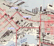 |
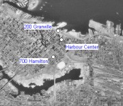
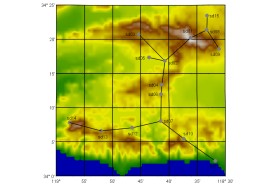
Map Grid Module
A new site network display module named “Map
Grid” has been added in the May 2001 program build. This operates in
parallel with the existing network module. The map grid module uses fixed
projections to display the network sites with both backdrops and
elevations. The backdrops can be in either a TIFF or Windows bit map (BMP)
format. The elevations must be in the Odyssey - Planet BIL format. This
feature is available as part of the microwave interference or area
coverage option. |
 |
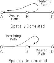 |
Multipath and Rain Fade Correlation
The interference fade margin / threshold
degradation has been split into two separate components for rain and
multipath. Default correlation values can be assigned for cases where the
main and interference paths are spatially correlated. A correlation editor
is provided which graphically displays each interference case in the
network module. This feature is available as part of the microwave
interference option.
|

SESR, BBER and ESR performance
calculations for SDH radio links has been implemented to accommodate the
additional radio data required for G.826 calculations. The format of the
following files has been changed.
Pathloss data files (pl4)
Microwave radio data files (raf and
mrs)
Microwave radio lookup tables
(mrd)
The May
2001 build program can read these data files and all previous versions.
Pathloss programs prior to the May 2001 build will not be able to read the
new files. |

|
Automated network
transmission design
Dynamic network outage
analysis
Network stability testing
for adaptive APTC radios
Composite interference
analysis under simulated rain conditions
This feature
is available to M/W interference module users
only |
 |
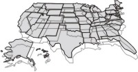
Network background display
With the January 2000 and
newer maintenance release the user can now have a terrain image as a
background in the network display. A new Add Site feature adds a new site
directly on the network display. In conjunction with the network
background, this feature will be useful in the initial planning
stages. |
 |
For Pathloss users in the
United States, the program ships with compressed 3 second terrain data for
the United States and Alaska on a single CD-ROM. This data has been taken
directly from the USGS 1:250,000 DEMS. |
 |
As a convenience to Pathloss
users, the program ships with USGS GTOPO30 data for the world (except for
the Antarctic region). The header and elevation data files are supplied in
the native USGS format on two
CD-ROMS. |
Related Links
1. Sites Data Entry & Creation of Network
2. Link by Link PATHLOSS Files Creation
3. Terrain Data & Obstruction Entry and Finding Suitable Antenna Heights
4. Link Budget Calculations
5. Frequency Interference Calculations for the Network
6. MSI PLANET Terrain Data UTM (Universal Transverse Mercator ) Projection
7. Configuration Terrain Database and Geographic Defaults
|